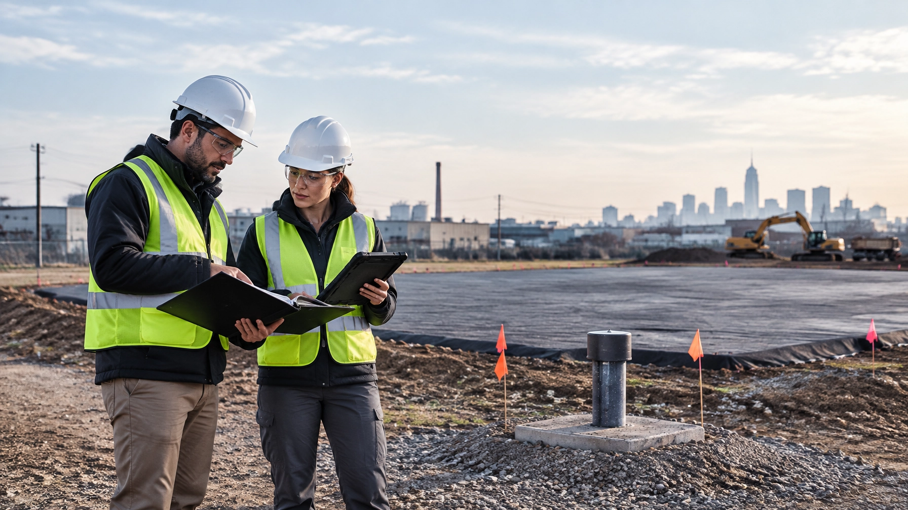
A qualified driller should not advance a boring until the proposed location has gone through a documented subsurface utility clearance.
A New Jersey One Call ticket or New York 811 markout is necessary. It is not the same as a complete clearance for environmental drilling.
Public utility markouts can miss private lines, abandoned services, undocumented piping, former underground storage tanks, buried drums, and construction debris. GPR adds a site-specific view of what is actually beneath the proposed boring grid. It also shows where the method reaches its limits.
For a Phase II Environmental Site Assessment in New Jersey, this matters for more than safety. GPR findings can change the boring locations, the number of samples, the Areas of Concern, the cost estimate, and the excavation limits.
Utility markouts are the starting point, not the clearance
New Jersey requires excavators to contact One Call before excavation or drilling. The standard notice window is generally three to ten business days before work begins. New York requires contact with New York 811 before mechanized excavation, generally two to ten working days in advance.
These systems notify participating utility operators. The operators mark facilities they own or maintain. They do not create a complete map of every subsurface feature on a private redevelopment parcel.
That distinction is important in Newark, Jersey City, Brooklyn, and Manhattan, where a site may contain:
- Private electrical and water services
- Abandoned gas or process piping
- Former heating-oil tank lines
- Utility laterals that do not appear on current plans
- Old foundations and slabs
- Buried drums or tanks
- Historic fill containing brick, metal, ash, concrete, and demolition debris
OSHA 29 CFR 1926.651 requires employers to determine the estimated location of underground installations before excavation and to use safe and acceptable means to determine the exact location as work approaches those installations. The rule also requires utilities to be protected, supported, or removed as necessary.
A utility ticket helps satisfy the notification step. It does not eliminate the need for field verification.
Read OSHA’s excavation and underground installation requirements.
What GPR can find before a Phase II boring
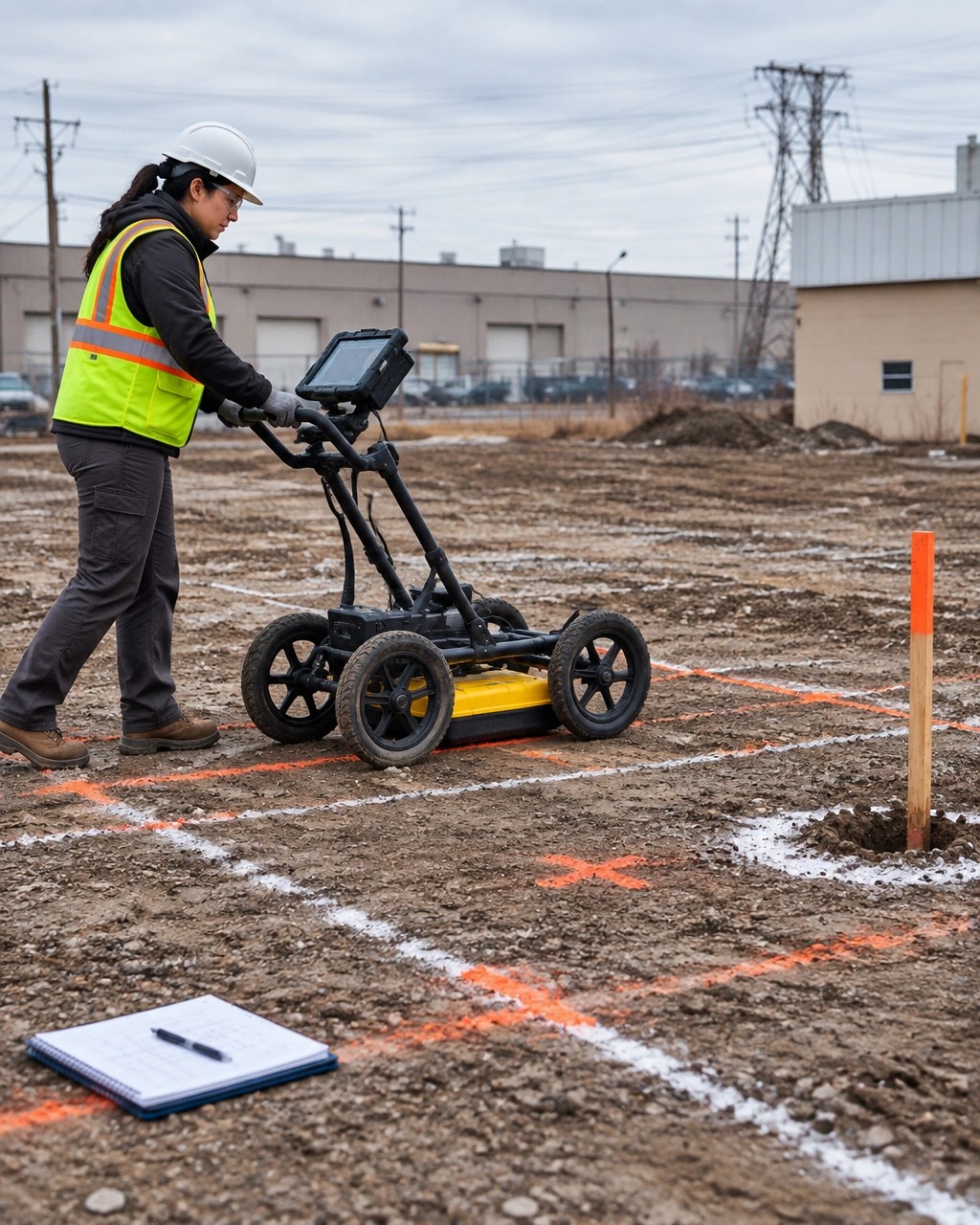
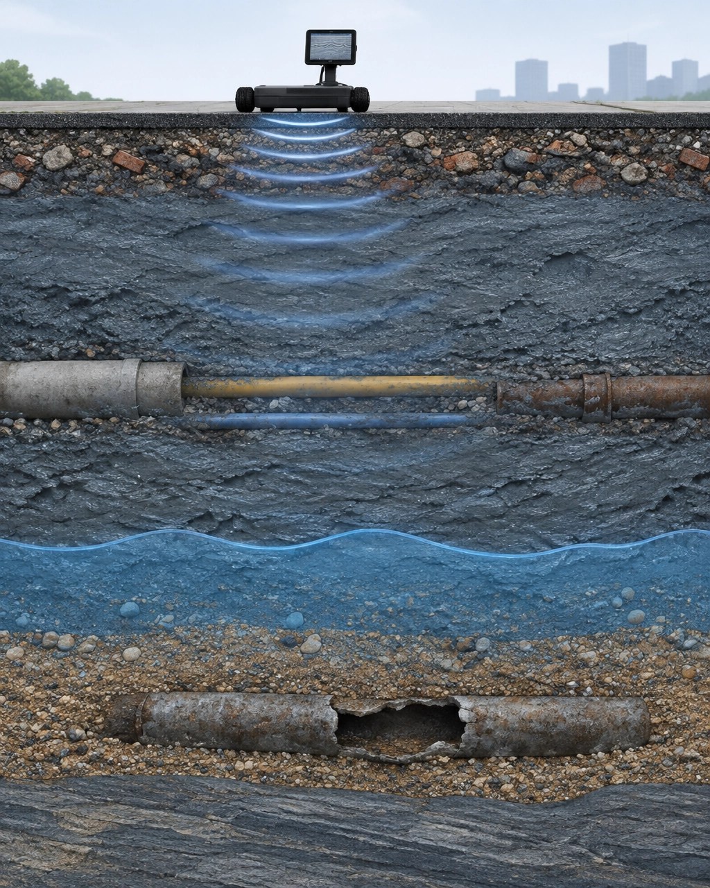
Ground penetrating radar sends electromagnetic pulses into the subsurface and records reflections from changes in material, density, moisture, and dielectric properties. A trained operator interprets those reflections across a gridded survey area.
GPR does not simply produce a picture of the ground. It produces evidence that must be interpreted against site history, utility records, surface conditions, and the Phase I findings.
Utilities and abandoned piping
GPR can identify many buried utility corridors, including:
- Water and sewer lines
- Electrical conduits
- Communication ducts
- Gas lines with detectable bedding or surrounding disturbance
- Metallic and nonmetallic piping
- Former process lines
- Abandoned service connections
The result is usually a mapped anomaly or corridor with an estimated depth and confidence rating. Metallic utilities should often be evaluated with electromagnetic locating equipment as well. GPR and EM locating answer different questions and work better together than either method alone.
Former USTs and associated piping
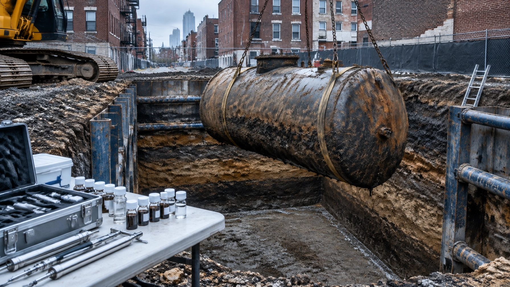
GPR can help locate suspected underground storage tanks, abandoned tanks, drywells, dispenser islands, and connecting product lines. This is especially useful when historical records show a former gas station, fuel-oil system, industrial operation, or heating-oil tank.
Finding the tank is only the first step. A tank anomaly can affect the Phase II scope by requiring:
- Soil borings around the tank perimeter
- Sidewall and bottom sampling during removal
- Product-line investigation
- Groundwater evaluation
- Additional analysis for petroleum-related compounds
- A separate UST closure or remediation pathway
GPR can help estimate the footprint of a tank and identify possible piping. It cannot determine whether a tank leaked or replace confirmatory sampling. That is why GPR should shape the investigation, not substitute for it.
Drums, buried debris, and historic fill
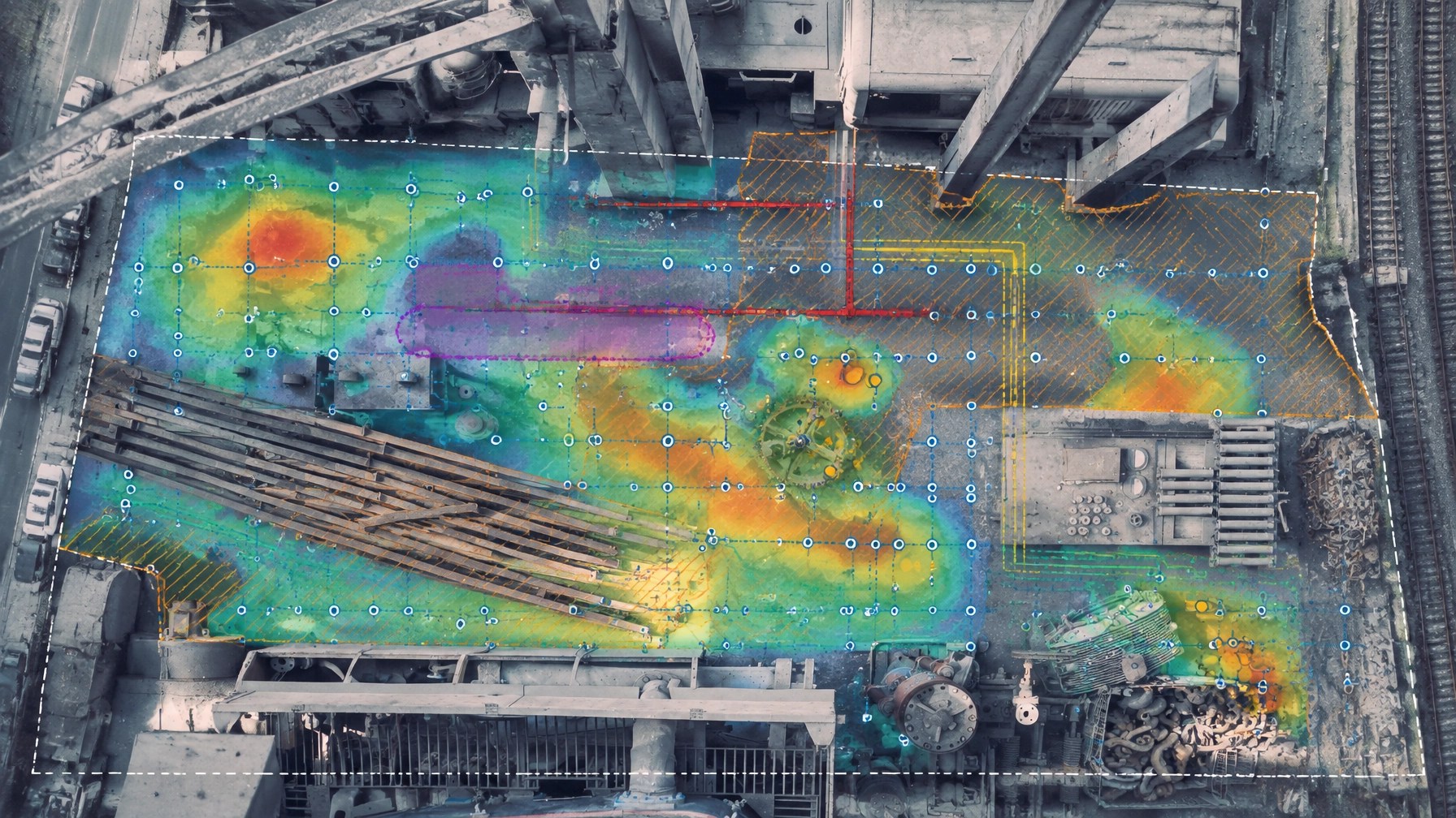
Strong, irregular reflections can indicate buried drums, concrete, metal, dense debris, voids, old slabs, or changes in fill composition. On urban sites, these anomalies may reflect historic demolition or industrial use rather than a single discrete object.
A mapped change in subsurface response can also help identify a probable historic fill boundary. That boundary can influence where to place borings and how to manage excavated soil.
NJDEP guidance requires investigators to evaluate historic fill when applicable during the Preliminary Assessment and Site Investigation process. Historic fill and separate Areas of Concern within that fill still need to be evaluated appropriately. A GPR survey can help identify where fill conditions change, but soil borings and laboratory data are required to characterize the material.
Review NJDEP’s Historic Fill Material Technical Guidance.
What GPR misses
GPR is powerful, but it is not a guarantee that nothing is below the surface. The most important conclusion from a GPR survey may be the area where confidence is low.
GPR may not reliably identify:
- Deep utilities below conductive soil
- Small or damaged nonmetallic lines
- Utilities without a strong material contrast
- Plastic piping in complex fill
- Features below reinforced concrete or dense surface materials
- Objects masked by multiple utilities or debris
- Buried features in saturated, clay-rich soil
- Contaminants that do not create a distinct physical anomaly
GPR also cannot determine the chemical contents of soil, a drum, or a tank. It cannot confirm a release. It cannot prove that an area is free of contamination.
Clay and groundwater can stop the signal
Clay-rich and saturated soils absorb electromagnetic energy. The signal becomes weak, noisy, and shallow. In some conditions, penetration may be less than one meter. In saturated clay, useful penetration can be limited to only a few inches or tens of centimeters.
That is a serious issue in parts of Newark, Jersey City, Hudson County, and waterfront areas of New York City. A clean-looking radargram in one portion of a site does not mean the entire parcel has equal detection reliability.
The report should identify:
- Soil and moisture conditions
- Antenna frequencies used
- Estimated depth of investigation
- Areas of signal attenuation
- Zones with interference or excessive clutter
- Features that require potholing, vacuum excavation, or another locating method
- Whether non-detection can be treated as meaningful
The governing rule is simple: no GPR response does not mean no utility.
Review the EPA CLU-IN overview of GPR limitations.
How GPR changes the Phase II investigation
A Phase II should answer the specific question raised by the Phase I. The boring plan should not be a generic grid placed without regard to subsurface constraints.
GPR results can change the plan in four ways.
1. Move boring locations safely
A proposed boring may sit directly over a private utility, abandoned line, tank, or concrete obstruction. The team can shift the boring while preserving the environmental objective.
2. Add targeted borings
A tank anomaly, piping corridor, debris zone, or historic fill transition may require additional locations. The goal is not to collect samples everywhere. The goal is to resolve the actual Areas of Concern.
3. Change sampling depth and media
If GPR suggests a tank or buried feature, the team may need to adjust soil intervals, collect groundwater samples, evaluate vapor, or plan for deeper investigation. If the water table is shallow, the drilling method and well design may also change.
4. Define excavation and soil management limits
A mapped debris or historic fill boundary can help the project team anticipate where excavation will generate suspect soil. That affects waste characterization, disposal planning, clean fill requirements, and the potential UST closure cost in New Jersey.
Project manager checklist for documented clearance
Before the rig mobilizes, confirm that the project file includes:
- Current NJ One Call or New York 811 ticket
- Utility operator responses and clearance status
- White-lined boring and excavation areas
- Current site plans and proposed boring coordinates
- Utility records, as-builts, and historical site plans
- Surface reconnaissance photographs
- GPR survey grid and equipment information
- EM locator results where applicable
- Mapped anomalies with estimated depths and confidence ratings
- Areas with limited signal penetration
- Confirmation plan for critical crossings or ambiguous features
- Final boring layout approved by the environmental professional and driller
- Field log showing clearance observations before drilling
- Stop-work procedure if an unexpected line, tank, odor, or obstruction is encountered
This documentation supports the field record. It shows that the team considered known and reasonably expected underground installations before drilling. It also gives the driller a clear basis for stopping or relocating work when field conditions differ from the plan.
When GPR must be re-run or supplemented
Re-run or supplement the clearance when:
- The boring grid moves materially
- The site grading or surface cover changes
- Asphalt, concrete, or fill is removed
- The original marks fade or are disturbed
- More than the ticket’s valid work window has passed
- New utility records become available
- Excavation exposes an unrecorded line or structure
- Recent rain or groundwater changes affect soil conditions
- The first survey shows severe signal attenuation
- A boring encounters unexpected debris, refusal, or piping
- The drill location enters a tolerance zone
- The project changes from shallow borings to deeper drilling
- A suspected UST, drum, or buried structure remains unresolved
For critical utilities, GPR alone may not be enough. Use EM locating, records review, hand excavation, vacuum excavation, or another safe verification method based on the site and the risk.
One team should own the clearance and the borings
The weakest project handoff is between a GPR vendor and a separate drilling contractor who never discuss the interpretation.
Envicon integrates GPR with Phase II ESA site investigation and characterization, UST closure, groundwater work, and remediation planning. The same project team can review the Phase I findings, run the clearance, place the borings, adjust the field program, and carry the data into the report.
That means one mobilization where practical, fewer handoffs, and no separate vendor asking the client to explain what the first consultant found.
In Newark, Jersey City, Brooklyn, and Manhattan, the subsurface is rarely simple. The job is not to promise perfect visibility. The job is to identify the risk, document the limits, and make the next field decision with the best information available.
The takeaway
Utility markouts tell you what participating owners know about their facilities. GPR helps show what the site itself may be hiding.
Before a Phase II boring advances, clear the location, document the method, understand the signal limits, and verify critical anomalies. That process protects workers, supports the field record, and produces a Phase II scope that reflects actual site conditions.
Get the subsurface right before you drill.
Plan your Phase II investigation
Envicon Group helps developers, property owners, attorneys, contractors, and lenders resolve subsurface uncertainty across New Jersey and New York City.